[ . BACK to DARUMA MUSEUM TOP . ]
. Kaido 街道 Highways - ABC Index .
::::::::::::::::::::::::::::::::::::::::::::::::::::::::::::::::::::::::::::::::::::::::::::::::::::::::::::::::::::::::::::::::::::::::::::::::::::::::::::::::::::::::::::::::::::
The old Shinano Province 信濃国 / Shinshū 信州 Shinshu
... now 長野県 Nagano Prefecture.
 - quote -
Shinano bordered on
1 Kōzuke, 2 Musashi, 3 Kai, 4 Suruga, 5 Tōtōmi, 6 Mikawa, 7 Mino, 8 Hida, 9 Etchu and 10 Echigo.
The ancient capital was located near modern-day 松本 Matsumoto, which became an important city of the province.
- Historical record
In 713, the road that traverses Mino and Shinano provinces was widened to accommodate increasing numbers of travelers through the Kiso District of modern Nagano Prefecture.
In the Sengoku period,
Shinano Province was often split among fiefs and castle towns developed, including
小諸 Komoro, 伊那 Ina, and 上田 Ueda. Shinano was one of the major centers of
Takeda Shingen's power during his wars with Uesugi Kenshin and others.
Suwa Taisha Shrine was designated as the chief Shinto shrine (ichinomiya) for the province.
In 1871, during the Meiji period,
with the abolition of the han system and the establishment of prefectures (Haihan Chiken) after the Meiji Restoration, Shinano Province was administratively separated in 1871 into Nagano and Chikuma prefectures. These two tentative governmental and territorial units were reconfigured together again in 1876. This became the modern prefecture of Nagano, which remains substantially unchanged from that time.
- - - More in the WIKIPEDIA !
. Suwa Taisha 諏訪大社 Great Suwa Shrine .
. Takeda Shingen 武田信玄 (1521 - 1573) .
::::::::::::::::::::::::::::::::::::::::::::::::::::::::::::::::::::::::::::::::::::::::::::::::::::::::::::::::::::::::::::::::::::::::::::::::::::::::::::::::::::::::::::::::::::
Hokkoku Kaido 北国街道 Hokkoku Highway Roads
From Oiwake on the 中仙道 Nakasendo Highway to 野尻宿
Nojiri into 越後 and on to the Echigo province.
 source : ktr.mlit.go.jp/nagano/sinsyukaidou/hokkoku...
- quote -
source : ktr.mlit.go.jp/nagano/sinsyukaidou/hokkoku...
- quote -
The
Hokkoku Kaido Road is the generic name of the main roads in Hokuriku region in the Edo period.
There were actually three main roads running through this region;
the 北陸道
Hokuriku-do Highway, which went to the west from Naoetsu (present Niigata Pref.),
the 北国西街道
Hokkoku Nishi Kaido (West Road), which linked Seba (present Shiojiri City) on the Nakasendo Road and Tanbajima (present Nagano City), and the
the 北国脇往還
Hokkoku Waki Okan (Byroad of the Hokkoku Highway).
At the present, this byroad is often referred to as the
Hokkoku Kaido Road.
The road with a total length of 140 km crossed the whole area of Shinshu region and linked Oiwake (present Karuizawa) on the Nakasendo Highway and Takada (present Joetsu City) on the Hokuriku Highway.
This road connecting the Pacific side and the Northern coastal side of the country played an important role as the gold route that carried the gold mined at Sado Gold Mine and the
sankin kotai (the system of “alternate attendance”) route of the feudal lords including that of Maeda clan, who were given the fiefs in the Hokuriku region.
It was also used for carrying commodities from the Hokuriku region to the Kanto region.
The road was sometimes called
“Zenkoji Kaido,” 善光寺街道 because it was used by the pilgrims visiting Zenkoji Temple in Nagano City. At the present, Route 18 traces about the same route as the Edo period Hokkoku Kaido.
- source : nippon-kichi.jp... -
. Shiotsu Kaido 塩津街道 Shiotsu Highway / 塩津海道 Shiotsu Sea Road .
with details about the Hokkoku Kaido roads
. Saku Koshu Kaido 佐久甲州街道 Saku Highway .
Also called
Koshu Okan 甲州往還
Koshu Road
Nezumijuku 鼠宿 postal station
. Iwabana no nezumi 岩鼻のねずみ the mice from Iwabana .
- - - Chikumagwa 千曲川と伝説
Legends about the river Chikumagawa
. Zenkooji 善光寺 Zenko-Ji in Nagano .

At 柏原宿 Kashiwabara station the highway forked into the 飯山道
Iiyama road and the
戸隠道
Togakushi road.
. Togakushi Kodo 戸隠古道 Togakushi Old Pilgrim Road .
::::::::::::::::::::::::::::::::::::::::::::::::::::::::::::::::::::::::::::::::::::::::::::::::::::::::::::::::::::::::::::::::::::::::::::::::::::::::::::::::::::::::::::::::::::
Iiyama Kaido 飯山街道 Iiyama Highway
Started at 神代宿 Kumashiro.

千曲川下流 飯山街道 古繪圖
source : kosho.or.jp/products...
- quote -
Iiyama (飯山市 Iiyama-shi) is a city located in Nagano Prefecture.
It markets itself as "Japan's Hometown" and is known as the "Little Kyoto of Snow Country".
- History
The area of present-day Iiyama was part of ancient
Shinano Province.
The area was part of the holdings of Iiyama Domain during the Edo period, and the core of the city was the
jōkamachi surrounding Iiyama Castle, held by a cadet branch of the Honda clan. The modern town of Iiyama was established within Shimominochi District, Nagano with the establishment of the municipalities system on April 1, 1889.
It was raised to city status on August 1, 1954 by the merger of the town of Iiyama with neighboring villages of Akitsu, Tokiwa, Yanagihara, Tozama, Kijima and Zuiho. The villages of Ōta and Okayama were also annexed in 1955. ...
- More in the Wikipedia -
Connecting Iiyama and 十日町 Tokamachi is now the Highway Nr. 117.
..............................................................................................................................................
Tani Kaido 谷街道 Tani Highway
Now Highway 403.
This highway started from 信濃国稲荷山 Shinano province,
Inariyama (長野県千曲市 Nagano, Chikuma city) along the river 千曲川 Chikumagawa to the town of
Iiyama in Nagano.
The old Inariyama postal station is also situated along the
Shinano Roman Kaido しなの浪漫街道 Romantic Road of Shinano
It started from 稲荷山 Inariyama, crossed 矢代 Yashiro, then along the river Chikumagawa to 中野 Nakano and
飯山
Iiyama, on to the 十日町街道
Tokamachi Kaido.
Inariyama is one of the areas with very much snow in winter. Travelers could go over the 富倉峠 Tomikura Toge pass to Arai 新井宿 to carry salt from 日本海 the Sea of Japan.
Oozasa Kaido 大笹街道 (おおざさかいどう) Ozasa Highway
started at the Hokkoku Nishi Road in 福島宿 Fukushima, passed over 仁礼
Nire (now 須坂市 Suzaka city), crossed the 鳥居峠 Torii Toge pass (1390m) and went on to 嬬恋村大笹 Tsumagoi village, Ozasa.
Nire Kaido 仁礼街道 Nire Highway
was the name Tani Kaido in 群馬県 Gunma prefecture.
Only two stations, from Nire to 沓掛宿 Kutsukake on the Nakasendo.
. Nakasendo 中山道 Nakasendo Highway .
National Route 403 is a national highway of Japan connecting Chūō-ku, Niigata and Matsumoto, Nagano,
with a total length of 352.8 km.
..............................................................................................................................................
Tokamachi Kaido 十日町街道 Tokamachi Highway
 - quote -
Tōkamachi
- quote -
Tōkamachi
derives its name from the fact that a market was held every tenth day of the month.
- History
The area of present-day Tōkamachi was part of ancient Echigo Province, and was part of the
tenryō territories held directly by then Tokugawa shogunate.
Following the Meiji restoration, was the capital of the newly-formed Nakauonuma District of Niigata Prefecture, and was proclaimed a village on April 1, 1889 with the creation of the modern municipalities system. It was raised to town status on September 24, 1897.
- - - More in the WIKIPEDIA !
..............................................................................................................................................
Matsunoyama Kaido 松之山街道 Matsunoyama Highway
Also called
Uesugi Gundo 上杉軍道 Army road of Uesugi
Matsunoyama was a town located in Higashi-Kubiki District, Niigata.
A road used by
Uesugi Kenshin, passing the old 松代町 Matsushiro town and leading his troups to war in the Kanto area.
The part between 菅刈 Sugakari and 犬伏 Inubuse is well preserved.
 - CLICK for enlargement and more info !
- quote -
- CLICK for enlargement and more info !
- quote -
Matsushiro (Matsudai) (Japanese: 松代 (まつしろまち)) was a historically important town in 埴科郡 Hanishina District, Nagano.
... Matsushiro was a thriving town as the center of Matsushiro Domain under the Sanada clan during the Edo period of the 17th to 19th centuries. In the Meiji period of the latter half of the 19th century, there was a thriving silk industry there. ...
- - - More in the WIKIPEDIA !
. Uesugi Kenshin Kagetora 上杉謙信(景虎) . (1530 - 1578)
 - quote -
The Matsunoyama Road was constructed by the warlord Uesugi Kenshin (1530-1578) as a military route to march troops to the Kanto region. It went through what was then Matsudaimachi, and links what is now 稲田 Inada in Joetsu City with 塩沢 Shiozawa, in 南上沼 Minami-Uonuma City. As the post station town of Matsudai-juku, the Matsudai region flourished as a transport hub.
Part of the mountain road from 菅刈 Sugakari to 犬伏 Inubuse, up to the 薬師峠 Yakushi Pass, has been selected by the Agency for Cultural Affairs as one of Japan’s Hundred Historical Roads.
- source : shibatouge.com/en/showplace -
.......................................................................
Legends from 十日町市 Tokamachi city 松之山町 Matsunoyama town
 - Matsunoyama Hot Spring
On the 15th day of the first lunar month,
people burn the kadomatsu 門松 pine decorations and first calligraphy of the year. They collect the ashes and paint the faces of others with it.
Once this habit was abolished, but soon there was misfortune in the village, fire broke out and mountains slided down the roads.
So they continued the custom and all was well again.
- - - - -
. jagirimaru 蛇切丸 sword to kill a serpent .
- - - - -
. hebi 蛇と伝説 Legends about snakes and serpents .
Once someone was feared to become ill, because he had killed a snake and was cursed by it.
He painted a snake on a piece of paper and posted it at the door of the local Shinto shrine to be safe.
- - - - -
Once a small snake was on top of a rock and called out with a very loud voice. Soon there was a great storm, the serpent changed into a dragon and flew to heaven.
The strong wind did not subside for a long time, but then there was a voice from the sky and the storm stopped.
When the villagers went to the mountain later, they found the dead body of a
daija 大蛇 huge serpent
- - - - -
. toshi toku jin, Toshitokujin 歳徳神 Deity of the Year .
According to ancient Asian lore, the new year comes with a new female deity.
She comes on the evening of day 30 of the 12th lunar month. People prepare the special kamidana 神棚 Shelf of the Gods for her.
When the year is over they tear it down and burn it, then built a new one.
::::::::::::::::::::::::::::::::::::::::::::::::::::::::::::::::::::::::::::::::::::::::::::::::::::::::::::::::::::::::::::::::::::::::::::::::::::::::::::::::::::::::::::::::::::
. Legends and Tales from Japan 伝説 - Introduction .
................................................................................. Niigata 新潟県
Legends from the Iiyama Kaido 飯山街道 Iiyama Highway
. itachi いたち weasel .
Once a man was
rusuban 留守番 alone taking care of the home, sitting on the veranda, when he heard a strange squeaking noise.
He remembered that weasels are afraid of fire, so he started a small fire and the noise stopped soon after.
- - - - -
. ryuu, ryū 龍 竜 伝説 Ryu - dragon legends .
A young woman who had been raped went up to the mountain to kill herself by jumping into the pond.
Now she became a dragon and the 池の主 Master of the Pond.
If people do mischief at this pond, there will suddenly be waves and thick fog.
..............................................................................................................................................
- reference : nichibun yokai database -
::::::::::::::::::::::::::::::::::::::::::::::::::::::::::::::::::::::::::::::::::::::::::::::::::::::::::::::::::::::::::::::::::::::::::::::::::::::::::::::::::::::::::::::::::::
 - - - To join me on facebook, click the image !
:::::::::::::::::::::::::::::::::::::::::::::::::::::::::::::::::::::::::::::::::::::::::::::::::::::::::::::::::::::::::::::::::::::::::::::::::::::::::::::::::::::::::::::::::::::
. kaidoo 街道と伝説 Legends about the old Kaido highways .
. Kaido 街道 Highways - ABC Index .
. Shinanochoo, Shinanomachi 信濃町 Shinano district . - Shinjuku
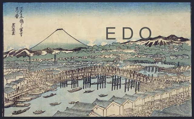
. Famous Places and Powerspots of Edo 江戸の名所 .
. Edo bakufu 江戸幕府 The Edo Government .
. Doing Business in Edo - 商売 - Introduction .
. shokunin 職人 craftsman, craftsmen, artisan, Handwerker .
. senryu, senryū 川柳 Senryu poems in Edo .
. Japanese Architecture - The Japanese Home .
. Interior Design - The Japanese Home .
. Legends and Tales from Japan 伝説 - Introduction .
[ . BACK to DARUMA MUSEUM TOP . ]
[ . BACK to WORLDKIGO . TOP . ]
- - - - - #iiyama #iiyamakaido - - - -
::::::::::::::::::::::::::::::::::::::::::::::::::::::::::::::::::::::::::::::::::::::::::::::::::::::::::::::::::::::::::::::::::::::::::::::::::::::::::::::::::::::::::::::::::::


