Showing posts sorted by date for query Ueno. Sort by relevance Show all posts

12/14/2019

Bungo Kaido Highway

[ . BACK to DARUMA MUSEUM TOP . ]
. Kaido 街道 Highways - ABC Index .
::::::::::::::::::::::::::::::::::::::::::::::::::::::::::::::::::::::::::::::::::::::::::::::::::::::::::::::::::::::::::::::::::::::::::::::::::::::::::::::::::::::::::::::::::::

Bungo Kaido 豊後街道 Bungo Highway

Connecting 熊本 Kumamoto city with 鶴崎 Tsurusaki in Oita.
About 124 km long. Now mostly National Highway 57.
In former times it took 5 days from Kumamoto to the harbour of Tsurusaki, and from there by ship on to Edo.


source : kusennjyu.exblog.jp...

Higo no Kuni Kumamoto 肥後国熊本 (present-day Kumamoto city)
Bungo no Kuni Tsurusaki 豊後国鶴崎 (present-day in Oita city)

Also called
Bungo Okan 豊後往還 Bungo Road / Higo Okan 肥後往還 Higo road

Built mostly by 加藤清正 Kato Kiyomasa for Sankin Kotai of 熊本藩 the Kumamoto domain
and 岡藩 the Oka domain (located in Oita).
The part leading from Oita to 肥後国 Higo no Kuni (Kumamoto) was called
Higo Kaido 肥後街道 Higo Highway.

. Kato Kiyomasa 加藤清正 (1562 - 1611) .

..............................................................................................................................................

- stations on the road -
Kumamoto castle, Fuda no Tsuji 熊本城の札の辻
大津 Ozu (菊池郡 Kikuchi district)
内牧 Uchinomaki
白丹 Shirani
久住 Kuju
境川 Sakaigawa
追分 Oiwake
上野 Ueno
神堤 Kamitsutsumi
今市 Imaichi
野津原 Notsuhara
木上 Kinoe
八幡田 Hachimanda
津守 Tsumori
萩原 Hagiwara
鶴崎 Tsurusaki


Kumamoto Prefecture
Starting Location: Kumamoto Castle (熊本城) (Kumamoto)
1. Ōzu-shuku (大津宿) (Ōzu, Kikuchi District)
2. Uchinomaki-shuku (内牧宿) (Aso)
3. Sakanashi-shuku (坂梨宿) (Aso)

Ōita Prefecture
4. Kujū-shuku (久住宿) (Taketa)
5. Imaichi-shuku (今市宿) (Ōita)
6. Notsuhara-shuku (野津原宿) (Ōita)
Ending Location: Port of Tsurusaki (鶴崎港) (Ōita)


野津原 Notsuhara

..............................................................................................................................................

The part from Kumamoto to Ozu was called
Ozu Kaido 大津街道 Ozu Highway.


The part from 大津町 Ozu town to 阿蘇市 Aso city was called
Seisho Kodo 清正公道(せいしょこどう)Road of Kiyomasa


.......................................................................

- - - - - Kumamoto no Ishitatami no Michi 石畳の道 old roads with stone pavement

At some parts of the old road there are still 石畳 stone pavements and 杉並木 roads lined with cedar trees.
The stone pavement was usually 3.8 m wide and sometimes lasted for more than 500 m.


Bentenzaka no ishitatami 弁天坂石畳 Benten slope
About 3.7 m wide and 80 m long. Built in 1807, taking 4 years.
Now there is a favorite promenade called 弁天坂の石畳.

Futae no Toge 二重峠 Futae Pass stone pavement


Imaichi no ishitatami 今市の石畳
野津原町今市の石畳 Notsuhara town Imaichi no ishitatami
About 8.5 m wide and 660 m long.
. . . CLICK here for Photos !

Sakanashi 坂梨 "no slope"
There was a postal station in Sakanashi.
From Sakanashi Sekisho 坂梨関所 the barrier station up to the slope of the outer ring of the mountain the pavement was 3 km long.
At the top of the slope was a Shrine, 護法社 Gosama ごうさま」.
- - - The Sakanashi clan 坂梨氏
阿蘇大宮司族 . High Priests at the Aso Shrine.
. Aso jinja 阿蘇神社 Aso Shrine .


Sakai no Matsuzaka ishitatami 境ノ松坂石畳
About 2.3 m wide and 200 m long. The stones are now covered with moss.
From here it is not far to the border of Oita. It was the last difficult pass in Higo.

stone pavement at Takimurozaka slope 滝室坂石畳
. . . CLICK here for Photos !

.......................................................................

hyakken ishigaki 百閒石垣 stone wall of 100 ken length
at Kumamoto castle, about 180 long.

The Samurai 山東弥源太 Santo Yagenta jumped down this wall to his death when he realized his life was lost during the fight.

..............................................................................................................................................

- quote -
- - - - - The Hosokawa clan 細川氏 - - - - -
The Hosokawa of Kokura (later Kumamoto) became the "main" line of the Hosokawa clan during the Edo period. Hosokawa Gracia, the wife of Hosokawa Tadaoki, was one of the most famous samurai converts to Christianity; she was also the daughter of Akechi Mitsuhide.
The Hosokawa sided with Tokugawa Ieyasu against Ishida Mitsunari during the decisive Sekigahara Campaign, and thus were made fudai (inside) daimyō under the Tokugawa shogunate. They were given Higo Province, with an income of 540,000 koku, as their han (fief).
Hosokawa Tadatoshi, the third lord of Kumamoto, was the patron of the swordsman Miyamoto Musashi.
- - - More in the WIKIPEDIA !

旧細川刑部邸 mansion of 細川興孝 Lord Hosokawa Okitaka
. . . CLICK here for Photos !


細川コレクション 永青文庫展示室 Hosokawa art collection museum
. . . CLICK here for Photos !


一夜塘(いちやども)Ichiyadomo Embankment to prevent flooding
. . . CLICK here for Photos !
Constructed in 1796 by 細川斉茲 Lord Hosokawa Narishige. The stone wall of about 70 length is still there.
If this embankment would break, the town of Kumamoto would be flooded "in one night" (ichiya 一夜).


武蔵塚公園 Musashizuka Koen - Miyamoto Musashi Park and memorial mound
Tatsuda yuge, Kita Ward, Kumamoto
To pray for the safe travel of Sankin Kotai to Edo by the Hosokawa clan.
Inscription : 新免武蔵居士石塔
. . . CLICK here for Photos !


上井手 Kami-Ide, Uwaide, Uwa-Ide / Kamiide
An irrigation canal of about 24 km length to prevent flooding from the river 白川.
Built by Kiyomasa, 細川忠利 Hosokawa Tadatoshi and 光尚 Hosokasa Mitsutoshi.
Uwaide became a postal station for the Hosokawa clan.
. . . CLICK here for Photos !


波奈之丸(なみなしまる)Naminashimaru
official ship for Sankin Kotai, stationed ad Tsurusaki.
. . . CLICK here for Photos !


鉄砲小路 Teppo Koji Road where the 鉄砲衆 gunmen lived
About 4 ml long, now national road nr. 311.
Built in 1635 by 細川忠利 Hosokawa Tadatoshi.
. . . CLICK here for Photos !

泰勝寺 Temple Taisho-Ji
remains of the Bodai-Ji 菩提寺 family temple of the Hosokawa clan
. . . CLICK here for Photos !

..............................................................................................................................................


熊本城本丸御殿 Kumamoto castle palace
. . . CLICK here for Photos !


立田口赤鳥居 red Torii gate at Tatsutaguchi
at the Shrine 立田口大神宮 Tatsutaguchi Daijingu / 竜田口 Tatsudaguchi
Tsuboi, Chuo Ward, Kumamoto
. . . CLICK here for Photos !

.......................................................................

鼻ぐり井手 Hanaguri Ide canal

The Hanaguri Ide is a specially constructed 387-meter canal in Kikuyō, Kumamoto, Japan, which lets water flow into the downstream without depositing the mixed ash. The Aso area from which water flows is rich in such ash, volcanic in nature.
Built around 1608 by Kato Kiyomasa.

.......................................................................

円通庵(芭蕉塚)Entsu-An and Mound for 芭蕉 Matsuo Basho
built in 1793 to commemorate the Haiku poet.
. . . CLICK here for Photos !

光尊寺 Temple Kosen-Ji
Built in 1652. With a stone brige at the entrance, built in 1815.
. . . CLICK here for Photos !

的石の御茶屋 Matoishi Tea House
Used during Sankin Kotai as a rest place. with a beautiful large park.
. . . CLICK here for Photos !

的石 Matoishi "the Target Rock"
The deity of Aso Shrine 健磐龍命 Tateiwatatsu no Mikoto used this rock to practise with bow and arrow, standing on 往生岳 Mount Ojodake, one of the five mountains of Aso.
The arrows were collected by 鬼八(きはち) Kihachi. Once Kihachi was not fast enough to bring the 100 arrows and the angry Deity cut off his head. Kihachi took revenge by blowing frost over the land, and the harvest was lost.
The shrine 霜宮 Shimomiya was built in his honor.
. 霜宮 Shimomiya . Shimo Jinja  霜神社 "Frost Shrine".

- extensive reference with photos - kumanago .jp -


::::::::::::::::::::::::::::::::::::::::::::::::::::::::::::::::::::::::::::::::::::::::::::::::::::::::::::::::::::::::::::::::::::::::::::::::::::::::::::::::::::::::::::::::::::


- quote
Bungo Province (豊後国, Bungo no kuni)
was a province of Japan in eastern Kyūshū in the area of Ōita Prefecture. It was sometimes called Hōshū (豊州), with Buzen Province.
Bungo bordered Buzen, Hyūga, Higo, Chikugo, and Chikuzen Provinces.
- - - - - History
At the end of the 7th century, Toyo Province was split into Buzen (literally, "the front of Toyo") and Bungo ("the back of Toyo"). Until the Heian period, Bungo was read as Toyokuni no Michi no Shiri.
It is believed that the capital of Bungo was located in Furugō (古国府), literally "old capital," section of the city of Ōita, but as of 2016 no archaeological evidence has been found.
The honor of the holiest Shinto shrine of Bungo Province (豊前一宮, Buzen ichinomiya) was given to Usa Shrine known as Usa Hachimangu or Usa Jingu in Usa district (today Usa, Ōita). Usa shrine had not only religious authority but also political influence to local governance, but their influence was reduced until the Sengoku period.
During the Sengoku period,
in the middle of the 16th century, Bungo was a stronghold of the Ōtomo clan. The Ōuchi clan in the western Chūgoku Region was influenced to Buzen politics. In the middle of the period, both clans declined. After Toyotomi Hideyoshi also took the power in Kyūshū, 120 thousand koku of Buzen province was given to Kuroda Yoshitaka since 1587, who made Kokura, currently part of Kitakyushu, Fukuoka, his site and built the castle. Other parts of the province were divided into pieces and given to other daimyōs.
In the year 1600
the Dutch ship piloted by the Englishman Will Adams foundered on Bungo's coast. When Shogun Tokugawa Ieyasu interviewed Adams, his suspicions were confirmed that the Jesuits, who had been allowed to operate in Japan since the 1540s, were intent on gaining control of the country. When the time was right, in 1614, Ieyasu banished all Christian activity. Thus, Adams' landing in Bungo proved significant to the nation's subsequent history.This series of historic events was the basis of the 1975 book Shogun, and the 1980 miniseries of the same name.
In the Meiji period,
the provinces of Japan were converted into prefectures. Maps of Japan and Bungo Province were reformed in the 1870s.
- source : wikipedia

- Historical districts -
Amabe District (海部郡)
Hayami District (速見郡)
Hita District (日高郡)
Kusu District (球珠郡)
Kunisaki District (国埼郡)
Naoiri District (直入郡)
Ōno District (大野郡)
Ōita District (大分郡)

..............................................................................................................................................

- quote -
Higo Province (肥後国, Higo no kuni)
was an old province of Japan in the area that is today Kumamoto Prefecture on the island of Kyūshū.
t was sometimes called Hishū (肥州), with Hizen Province. Higo bordered on Chikugo, Bungo, Hyūga, Ōsumi, and Satsuma Provinces.
- - - - - History
The castle town of Higo was usually at Kumamoto City.
During the Muromachi period, Higo was held by the Kikuchi clan, but they were dispossessed during the Sengoku period, and the province was occupied by neighboring lords, including the Shimazu clan of Satsuma, until Toyotomi Hideyoshi invaded Kyūshū and gave Higo to his retainers, first Sassa Narimasa and later Katō Kiyomasa. The Kato were soon stripped of their lands, and the region was given to the Hosokawa clan.
During the Sengoku Period,
Higo was a major center for Christianity in Japan, and it is also the location where Miyamoto Musashi stayed at the Hosokawa daimyō's invitation while completing his The Book of Five Rings.
In the Meiji period, the provinces of Japan were converted into prefectures. Maps of Japan and Higo Province were reformed in the 1870s. At the same time, the province continued to exist for some purposes.
For example, Higo is explicitly recognized in treaties in 1894 (a) between Japan and the United States and (b) between Japan and the United Kingdom.
- source : wikipedia -

- Historical districts -
Akita District (飽田郡)
Amakusa District (天草郡)
Ashikita District (葦北郡)
Aso District (阿蘇郡)
Gōshi District (合志郡)
Kikuchi District (菊池郡)
Kuma District (球磨郡)
Mashiki District (益城郡)
Takuma District (託麻郡)
Tamana District (玉名郡)
Uto District (宇土郡)
. Yamaga 山鹿 .
Yamamoto District (山本郡)
Yatsushiro District (八代郡)


- quote -
The Kikuchi clan (菊池氏, Kikuchi-shi) of Higo Province
was a powerful daimyō family of Higo, Kyūshū. The lineage was renowned for valiant service in defense of the emperor and against foreign invaders. They first distinguished itself during the Jürchen invasion of northern Kyūshū in 1019 and rose to prominence during the Mongol invasions of Japan, when the heroism of Kikuchi Takefusa helped drive back the enemy.
The Kikuchi were active in the Kenmu Restoration (1333-1336), an attempt by the emperor Go-Daigo to reassert imperial authority against the Kamakura shogunate.

Kikuchi Noritaka / Fujiwara no Noritaka 藤原則隆 - Heian period
Kikuchi Jirō Takefusa (菊池 次郎 武房) (1245 – 1285)
Kikuchi Yuriko (1505–1554) - The last and 26th head of the Kikuchi Clan ...
- - - More in the WIKIPEDIA !


菊池一族 The Kikuchi Clan
阿蘇品保夫 Asoshina Yasuo


::::::::::::::::::::::::::::::::::::::::::::::::::::::::::::::::::::::::::::::::::::::::::::::::::::::::::::::::::::::::::::::::::::::::::::::::::::::::::::::::::::::::::::::::::::


. Satsuma Kaido 薩摩街道 Satsuma Highway .

Bungo Kaido (this page)

. Buzen Kaido 豊前街道 Buzen Highway .

. Hyuga Kaido 日向街道 Hyuga Highway .

. Miike Kaido 三池街道 / Miike Okan 三池往還 Miike Road . - Kumamoto

::::::::::::::::::::::::::::::::::::::::::::::::::::::::::::::::::::::::::::::::::::::::::::::::::::::::::::::::::::::::::::::::::::::::::::::::::::::::::::::::::::::::::::::::::::


. Legends and Tales from Japan 伝説 - Introduction .

豊後国直入地方の民間伝承 Legends from the Naoiri region of Bungo.
長山源雄 Nagayama Motoo

shiratori 白鳥 a white bird
The emperor 景行天皇 Keiko Tenno (大足彦天皇) had dispatched 菟名手(うなて)Unate (Unade), an ancestor of the Bungo regents, to Bungo, to the village 中臣村 Nakatomi.
He saw a white bird coming from the North and caught it.
The bird turned into mochi 餅 rice cakes, then into many thousand ietsuimo 芋草 plants.
So the Emperor named this area 豊国 Bungo "rich and plentiful land".

. Buzen Kaido 豊前街道 Buzen Highway .
and Emperor Keikō (景行天皇, Keikō-tennō) (13 BC - 130)


................................................................................. Oita 大分県
直入郡 Naoiri district 柏原村 Kashiwara village

sakana 魚 fish
Once upon a time
a man from the hamlet Hiroto caught a large fish at the riverside 黒太郎淵 Kurotarobuchi.
He wanted to carry it home in the net when he heard a voice from the river and the fish answered.
Afraid the man hung the net on a pine tree and run away as fast as he could.


................................................................................. Kumamoto 熊本県
菊池郡 Kikuchi district 大津町 Ozu town

. amagoi 雨乞いと伝説 Legends about rain rituals / Regenzauber .
At the Shrine in 肥後の真木村 Maki village in Higo the main festival is on the 15th day of the 10th lunar month.
Even if the day starts out fine, there will be a lot of rain later on.
If the day starts with clouds, there will be no rain later on.

..............................................................................................................................................

- reference : nichibun yokai database -

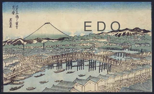
. Edo, Tokyo 江戸 - 東京 - 伝説 Legends Index .
26 豊後国 (01)
66 豊後

::::::::::::::::::::::::::::::::::::::::::::::::::::::::::::::::::::::::::::::::::::::::::::::::::::::::::::::::::::::::::::::::::::::::::::::::::::::::::::::::::::::::::::::::::::


- - - To join me on facebook, click the image !

:::::::::::::::::::::::::::::::::::::::::::::::::::::::::::::::::::::::::::::::::::::::::::::::::::::::::::::::::::::::::::::::::::::::::::::::::::::::::::::::::::::::::::::::::::::

. kaidoo 街道と伝説 Legends about the old Kaido highways .

. Kaido 街道 Highways - ABC Index .

. Famous Places and Powerspots of Edo 江戸の名所 .

. Edo bakufu 江戸幕府 The Edo Government .

. Doing Business in Edo - 商売 - Introduction .

. shokunin 職人 craftsman, craftsmen, artisan, Handwerker .

. senryu, senryū 川柳 Senryu poems in Edo .

. Japanese Architecture - The Japanese Home .

. Interior Design - The Japanese Home .

. Legends and Tales from Japan 伝説 - Introduction .


[ . BACK to DARUMA MUSEUM TOP . ]
[ . BACK to WORLDKIGO . TOP . ]
- - - - - #bungo #bungokaido - - - -
::::::::::::::::::::::::::::::::::::::::::::::::::::::::::::::::::::::::::::::::::::::::::::::::::::::::::::::::::::::::::::::::::::::::::::::::::::::::::::::::::::::::::::::::::::

8/24/2019

Ise Kaido Pilgrim Roads

[ . BACK to DARUMA MUSEUM TOP . ]
. Kaido 街道 Highways - ABC Index .
. Isemairi, Ise Mairi 伊勢参り Pilgrimage to Ise - Legends .
::::::::::::::::::::::::::::::::::::::::::::::::::::::::::::::::::::::::::::::::::::::::::::::::::::::::::::::::::::::::::::::::::::::::::::::::::::::::::::::::::::::::::::::::::::

Ise no Kaido 伊勢の街道 Pilgrim roads to Ise
There were many popular pilgrims road to the Grand Shrine at Ise..
The main road from Edo to Ise is the
Ise Sangu Kaido 伊勢参宮街道 / 伊勢街道 Ise Kaido
Ise city 伊勢市, where the Shrine is located, used to be called Ujiyamada 宇治山田 Uji Yamada.


Ise Jingū 伊勢神宮 Ise Jingu, Grand Shrine at Ise .
- Introduction -


. Isemairi, Ise Mairi 伊勢参り Pilgrimage to Ise - Legends .


..............................................................................................................................................


Ise udon 伊勢うどん served at the shrine Ise Jingu  
They are rather thick with mochigome glutinous rice.
They come with a thick "black" soy sauce broth, and a few cut leek rings.


::::::::::::::::::::::::::::::::::::::::::::::::::::::::::::::::::::::::::::::::::::::::::::::::::::::::::::::::::::::::::::::::::::::::::::::::::::::::::::::::::::::::::::::::::::


Ise Sangu Kaido 伊勢参宮街道 / 伊勢街道 Ise Kaido


Leaving the Tokaido at 日永の追分 Hinaga no Oiwake, leading to Ise.
Passing 白子 Shirako, 津 Tsu, 松阪 Matsuzaka and 斎宮 Saiku (Saigu).
About 70 km. Now mostly Highway 428.
Saiku, also called Itsuki-no-miya, was a shrine in a village located approximately 10 kilometers north-west of Ise Shrine,

Next after Oiwake on the Tokaido is
. Nr. 42 - Kuwana-juku 桑名宿 Kuwana postal station .


::::::::::::::::::::::::::::::::::::::::::::::::::::::::::::::::::::::::::::::::::::::::::::::::::::::::::::::::::::::::::::::::::::::::::::::::::::::::::::::::::::::::::::::::::::


Ise Betsu Kaido 伊勢別街道
Also called
「いせみち」Isemichi, 「参宮道」Sangumichi, 「山田道」Yamadamichi
There were many postal stations along this road, used by many people coming from Kyoto to Ise.

Leaving the the Tokaido at Seki 関宿, via 椋本宿 Mukumoto (Tsu city), 津市一身田 Isshinden in Tsu,
back to the main Ise Kaido at 江戸橋 Edobashi in Tsu city.
At the bridge Edobashi there was a large stone lantern, to keep the place light even at night.


. Sekijuku 関宿 Seki Shukuba Postal Station .


::::::::::::::::::::::::::::::::::::::::::::::::::::::::::::::::::::::::::::::::::::::::::::::::::::::::::::::::::::::::::::::::::::::::::::::::::::::::::::::::::::::::::::::::::::


Ise Hon Kaido, Honkaido 伊勢本街道
From Osaka, Shrine 玉造稲荷神社 Tamatsukuri Inari Jinja, passing 榛原 Haibara, 御杖村 Mitsue village, 横野 Yokono, 奥津 Okutsu, (津市)Tsu city leading to Ise.


- - - - - There are many shido 支道 branch roads leading to the main Ise Kaido.

::::::::::::::::::::::::::::::::::::::::::::::::::::::::::::::::::::::::::::::::::::::::::::::::::::::::::::::::::::::::::::::::::::::::::::::::::::::::::::::::::::::::::::::::::::


Iga Kaido 伊賀街道 Iga Kaido
Connecting Ise with Iga Ueno.
From 津 Tsu via the pass 橡ノ木峠 Tochinoki Toge (also called 長野峠 Nagano Toge, 美里 Misato town
to 伊賀国上野 Iga Ueno.
About 50 km. Now National Highway Nr. 163.
A crossing point was at present-day 松阪市中林町 Matsusaka city, Nakabayashi.

- - - - - A road taken by Matsuo Basho 芭蕉が歩いた伊賀の街道
(1)長野峠(美里村平木~大山田村上阿波1)Pass Nagano Toge
(2)長野峠(美里村平木~大山田村上阿波2)Pass Nagano Toge
(3)平松宿(大山田村平松~下阿波)Hiramatsu juku postal station
(4)平田宿(大山田村中村~平田)Hirata juku
(5)荒木(上野市荒木~西明寺)Araki, Temple Saimyoji
(6)上野(上野市西明寺)Ueno, Temple Saimyoji
- reference source : ict.ne.jp/~basho/guide... -


Igagoe Naramichi 伊賀越奈良道 Road crossing Iga to Nara
Includes most of the roads mentioned below:
伊勢国から伊賀国上野へ至る街道である大和街道・伊賀街道・奈良街道と、伊賀国上野から山城国を経て大和国奈良へ至る街道である笠置街道の総称。奈良街道や伊勢参宮街道に含まれる。
- wikipedia -


::::::::::::::::::::::::::::::::::::::::::::::::::::::::::::::::::::::::::::::::::::::::::::::::::::::::::::::::::::::::::::::::::::::::::::::::::::::::::::::::::::::::::::::::::::


Hase Kaido 初瀬街道
From Hase (in Sakurai city, Nara) to 松阪 Matsuzaka in Mie. The modern spelling of Hase is 長谷.
Also called
Sangu Ura Kaido 参宮表街道 "back road to the Ise Shrine"
Now National Highway Nr. 165.
Exists since about 672, the jinshin no ran 壬申の乱 "war of succession" in the Asuka period.
The main stations are
桜井市 - Sakurai city - 初瀬 Hase
宇陀市 - Uda city - 萩原 Hagihara(伊勢本街道との分岐・追分)
名張市 - Nabari city - 鹿高 Kataka, 名張 Nabari, 新田 Shinden
伊賀市 - Iga city - 阿保 Abo (伊勢路)
津市 - Tsu city - 垣内 Kaido, 二本木 Nihongi, 大仰 Ogyo and 八太 Hatta.
松阪市 - Matsuzaka city - 六軒 Rokken

. Hasedera 長谷寺 Temple Hase-Dera / はつせ Hatsuse .


初瀬街道まつり Hase Kaido Festival
Held in 奈良県桜井市長谷 Hase, Sakurai city, Nara.
- reference source : igayaki.or.jp... -


Jinshin War (壬申の乱 jinshin no ran)
- - - More in the WIKIPEDIA !


::::::::::::::::::::::::::::::::::::::::::::::::::::::::::::::::::::::::::::::::::::::::::::::::::::::::::::::::::::::::::::::::::::::::::::::::::::::::::::::::::::::::::::::::::::


. Kasagi Kaido 笠置街道 Kasagi Highway .
From 伊賀上野 Iga Ueno to 笠置山 Kasagiyama.
Kasagidera 笠置寺 Temple Kasagi-Dera

::::::::::::::::::::::::::::::::::::::::::::::::::::::::::::::::::::::::::::::::::::::::::::::::::::::::::::::::::::::::::::::::::::::::::::::::::::::::::::::::::::::::::::::::::::


Kamitsumichi 上ツ道 / 上街道 Kami Kaido
An old kandoo 官道 road for officials.
Since the Asuka period, leading from North to South through the plain of Nara.
From 奈良市 Nara to 天理市 Tenri to 桜井市 Sakurai
Now Highway 169.


::::::::::::::::::::::::::::::::::::::::::::::::::::::::::::::::::::::::::::::::::::::::::::::::::::::::::::::::::::::::::::::::::::::::::::::::::::::::::::::::::::::::::::::::::::


Nara Kaido 奈良街道
Also called
Yamato Kaido 大和街道
From Osaka, Shrine 玉造稲荷神社 Tamatsukuri Inare Jinja to 桜井 Sakurai (Nara), then joining the
Hase Kaido 初瀬街道
at 宇陀市 Uda city, on to Ise.

On the way was a pass to cross over, with its own name
Kuragarigoe Nara Kaido (Kuragoshi, Kurayami) 暗越奈良街道 (くらがりごえならかいどう)
The pass 暗峠 Kuragari Toge is 455 m high.
One of the 日本の道100選 100 famous roads of Japan.
There was also the pass 榁木峠 Muronoki Toge (268 m) to cross on the way and
追分梅林 Oiwake Bairin, plum tree forest at Oiwake, 1912 Owadacho, Nara.


浪花百景より : 玉造 Tamatsukuri
- - - More in the WIKIPEDIA !


- - - - - Along the Nara Kaido are more sub-roads :

Fushimi Kaido 伏見街道
Furutsutsumi Kaido 古堤街道
Jusan Kaido 十三街道
Kiyotaki Kaido 清滝街道
Ooto Kaido おおと街道
Shuntoku Kaido 俊徳街道
Takeda Kaido 竹田街道
Tateishi Kaido 立石街道
Tatsutagoe Nara Kaido 竜田越奈良街道


.......................................................................

. Kaido 街道と伝説 Legends about the old Kaido highways .

. oonyuudoo 大入道 Onyudo, O-Nyudo legends .
A man saw a a strange monster with a green face near the Rokujizoo, roku jizo 六地蔵 Statues of Six Jizo Bosatsu along the 奈良街道 Nara Kaido. He ran home in great fear. He had seen O-Nyudo.
- - - - -
. tanuki 狸 / mujina 狢 racoon dog, badger legends .
When Hayashi san was still a child, he often heard stories about people traveling along 奈良街道 the Nara Kaido at night, having their fish stolen by a Tanuki.


::::::::::::::::::::::::::::::::::::::::::::::::::::::::::::::::::::::::::::::::::::::::::::::::::::::::::::::::::::::::::::::::::::::::::::::::::::::::::::::::::::::::::::::::::::


. Takenouchi Kaido 竹内街道 / 竹ノ内街道 .
also called
Yoko-Ooji 横大路 Yoko-Oji, Yokooji


- source and many photos : matsubara city -
難波大道 Naniwa Daido


::::::::::::::::::::::::::::::::::::::::::::::::::::::::::::::::::::::::::::::::::::::::::::::::::::::::::::::::::::::::::::::::::::::::::::::::::::::::::::::::::::::::::::::::::::


Yamato Kaido 大和街道
- see above, Nara Kaido.

::::::::::::::::::::::::::::::::::::::::::::::::::::::::::::::::::::::::::::::::::::::::::::::::::::::::::::::::::::::::::::::::::::::::::::::::::::::::::::::::::::::::::::::::::::

Yamanobe no michi 山辺の道 / 山辺道
One of the old Yamato Kaido roads.
Through the Nara plain to the sacred 三輪山 Mount Miwasan and then to 春日山 Mount Kasugayama.
From Nara to Sakurai, and then on to Ise.


- Look at the large map here:
- reference source : nishida-s.com..yamanobenomichi... -

- quote -
The Yamanobe-no-Michi trail
passes through some of Nara’s most historic areas. It is dotted with shrines, temples and ancient tombs. Along the way are many cafes, rest stops and fruit stands in the summer.
... from Tenri to Sakurai takes three to four hours ...
- reference source : visitnara.jp/destinations... yamanobe-no-michi... -


. Miwa san, Miwa yama 三輪山 Mount Miwa .
Shrine Omiwa Jinja 大三輪神社 // Temple Omiwadera 大三輪寺

. Kasuga Taisha 春日大社 Great Shrine in Kasuga .

. Isonokami Jingu 石上神宮 Isonokami Shrine .
The shrine is at the northern end of the Yamanobe no michi, the oldest road in Japan.


::::::::::::::::::::::::::::::::::::::::::::::::::::::::::::::::::::::::::::::::::::::::::::::::::::::::::::::::::::::::::::::::::::::::::::::::::::::::::::::::::::::::::::::::::::


安永餅 Yasunaga mochi

- Mochi Kaido 餅街道 Road of the rice cakes -
From 桑名 Kuwana until the Ise Shrine.
There are many tea stalls on the roadside serving tea and rice cakes. They all have a special taste to offer and are very popular to our day.
There are also many tea stalls along the nearby road to Kumano 熊野街道.
Kuwana was known as Juraku no tsu 十楽の津.

お餅でつなぐ伊勢街道&その手は桑名の都まんじゅう
- reference source : kuwanacci.com/20151024-25motiura... -


::::::::::::::::::::::::::::::::::::::::::::::::::::::::::::::::::::::::::::::::::::::::::::::::::::::::::::::::::::::::::::::::::::::::::::::::::::::::::::::::::::::::::::::::::::


...................................................................... A legend from Nagano 長野県
.......................................................................
下伊那郡 Shimoina district 阿南町 Anan town

okuwa sama, o-kuwa sama オクワ様 / 鍬 venerable hoe
The reason why O-Kuwa sama is venerated:
Around 1860 a group of politicians wanting change started from the Shrine 皇太神宮 Kotai Jingu in Ise. They walked along all the villages of the 伊勢街道 Ise Kaido, carrying the hoe in a palanquin, singing local songs, performing shishimai 獅子舞 lion dances and tried to involve the villagers.
They were not allowed to pass the sekisho 関所 barrier station at 帯川 Obikawa, so they left all their tools there and went back home.
Now they venerate O-Kuwa Sama only in years with a good harvest.


::::::::::::::::::::::::::::::::::::::::::::::::::::::::::::::::::::::::::::::::::::::::::::::::::::::::::::::::::::::::::::::::::::::::::::::::::::::::::::::::::::::::::::::::::::


- - - - - H A I K U and S E N R Y U - - - - -

. Ise Shrine and its KIGO .

. O-Ise-Mairi, Ise Mairi 伊勢参り Ise Shrine Pilgrimage .
Ise sanguu 伊勢参宮(いせさんぐう)
O-kage mairi お陰参り (おかげまいり)"Thanks pilgrimage" or "blessing pilgrimage"
nuke mairi 抜参(ぬけまいり)leaving secretly and beg your way to Ise
isekoo 伊勢講(いせこう)Ise Shrine Group
saka mukae 坂迎え(さかむかえ)


::::::::::::::::::::::::::::::::::::::::::::::::::::::::::::::::::::::::::::::::::::::::::::::::::::::::::::::::::::::::::::::::::::::::::::::::::::::::::::::::::::::::::::::::::::


- - - To join me on facebook, click the image !

:::::::::::::::::::::::::::::::::::::::::::::::::::::::::::::::::::::::::::::::::::::::::::::::::::::::::::::::::::::::::::::::::::::::::::::::::::::::::::::::::::::::::::::::::::::

. kaidoo 街道と伝説 Legends about the old Kaido highways .

. Kaido 街道 Highways - ABC Index .

. Famous Places and Powerspots of Edo 江戸の名所 .

. Edo bakufu 江戸幕府 The Edo Government .

. Doing Business in Edo - 商売 - Introduction .

. shokunin 職人 craftsman, craftsmen, artisan, Handwerker .

. senryu, senryū 川柳 Senryu poems in Edo .

. Japanese Architecture - The Japanese Home .

. Interior Design - The Japanese Home .

. Legends and Tales from Japan 伝説 - Introduction .


[ . BACK to DARUMA MUSEUM TOP . ]
[ . BACK to WORLDKIGO . TOP . ]
- - - - - #isekaido #narakaido #isesangu #isebetsu #igakaido #hasekaido #yamatokaido #takenouchi - - - -
::::::::::::::::::::::::::::::::::::::::::::::::::::::::::::::::::::::::::::::::::::::::::::::::::::::::::::::::::::::::::::::::::::::::::::::::::::::::::::::::::::::::::::::::::::

5/20/2019

Okachimachi district Taito

[ . BACK to DARUMA MUSEUM TOP . ]
. Famous Places and Power spots of Edo 江戸の名所 .
::::::::::::::::::::::::::::::::::::::::::::::::::::::::::::::::::::::::::::::::::::::::::::::::::::::::::::::::::::::::::::::::::::::::::::::::::::::::::::::::::::::::::::::::::::

Okachimachi 御徒町 Okachimachi district
Taito ward, Okachimachi , 御徒町一丁目 - 三丁目 Okachimachi first to third sub-district
仲御徒町 Nakaokachimachi 一丁目 - 仲御徒町四丁目 first to fourth sub-district.
After 1964, the area was re-distributed and is now part of
台東区台東 Taito and 東上野 Higashi-Ueno.


The name refers to the foot guards of the Shogun,
okachigumi, o-kachi-gumi 御徒組 / okachigata 御徒方.

The kachi 徒 were very low-ranking Samurai.
Their living quarters were here.
They had to look after the safety of the road when the Shogun was going out.
Many had a low income and had to work at other jobs to make ends meet.

The O-Kachi samurai were divided in various groups:
本丸15組 15 groups for the Honmaru part of Edo castle.
西ノ丸5組 5 groups for Nishi no Maru.
Each group had two leaders and about 28 members.

okachi 御徒 is also spelled 徒士.

goyoogeikoo 御用稽古 "official training" of the Ssamurai of Edo castle.
Swimming was especially taught to the elite of the groups.


- quote
... a 徒 kachi is one of the lowest ranking samurai of the Edo Period. They were not permitted to ride horses. Until the 1800’s, they were not allowed to wear clothes with a family crest as their families were not considered successive clans. Some people draw a parallel between this rank of samurai and low level salarymen and low level management of Tōkyō – the analogy being in the type of housing and accessible neighborhoods according to their salary. This isn’t a good analogy, in my opinion, in that the samurai ranks were highly regulated by the Tokugawa Bakufu and a modern worker can marry “out of his station” or just move to the suburbs and get a bigger place. ...
... Even though these kachi were direct retainers of the shōgun, they were a kind of non-commissioned officer. They were expected to live in barracks. In many cases they wouldn’t be granted permission to live with their wives and children. In times of war, they were forbidden from marching in the vanguard. In times of peace, they were basically the white trash of Japan. They were supposedly privileged, but in reality, they were just commoners. The commoners had to show deference to them, but the rest of the samurai elite probably shat on them. ...
... the whole area from O-kachimachi to Ueno is considered the low town today. ...
- source : japanthis - Marky Star


- Other Samurai in service of Edo castle:
oobangumi 大番組 Obangumi, castle guards
onandogumi 御納戸組 keepers of the Shogun's personal stores.

Their living quarters were the
kumiyashiki 組屋敷 group residence

.......................................................................

- quote -
Okachimachi
is an area on the JR Yamanote Line, just south of the major Ueno Station. It is one of the areas of Tokyo that is well known for its shopping and excellent range of foodie options. Expect lots of fashionable youngsters here and crowds of hungry shoppers.
- - What to eat and drink in Okachimachi
There is a shopping street in the Okachimachi area called Taito-ku’s Torigoe. This is where you must go for eating and drinking. The street features around 230 shops that sell a huge range of groceries, ready-made meals and the very traditional and well-loved okazu (sides). This is Japan, so eating on the street and walking is frowned upon, but luckily street-snacking is more than welcome here as there is a small designated rest area with tables and chairs, which is found near the middle of the street. Eat away friends. Do note that most of the shops are closed on a Sunday.
There is of course sushi
to be had in this area. Head to Ginzo Sushi for some tasty options. The atmosphere of the restaurant is relaxing with piano jazz playing and there are also smoking and non-smoking seats, which can be rare to find in Tokyo. Go for the Sakura Nigiri Set for 790 yen, which includes 8 pieces of sushi, chawanmushi (a type of savory egg custard and prawn) and a delicious miso soup. Lunch sushi sets will cost you from 790 yen up to 2,600 yen. If you’re not a sushi fan, they also have a good range of other sets which include udon, grilled fish, tempura and donburi. Great value and great choice here.
- - - What to do in Okachimachi
Ameyokocho is said to be Japan’s last black market. This little number is great for both food and shopping. It really is just a random selection of stalls here. You can see heaps of clothes racks filled with shoes and coats. At another place will see you okonomiyaki, another monja, some French and Italian cuisine here, and other types of Asian restaurants there. You can find running shoes, perfumes, toys, watched, lychees, kebabs and shaved ices all in the same vicinity—the possibilities really are endless. Go here for an interesting and ever-ending browse.
Let’s get some shoes.
Told you this area was a fashion hub. With heaps of options at this shoe haven of an area, your feet will feel fabulous at any of these Okachimachi finds. Hit AbAb for a very good summer sale with pairs of shoes being reduced from 7,000 to as a little as 1,000 yen—bargain! (Do be warned though, if you have a larger size of feet for a woman, you may struggle to find a shoe that fits in Japan!)
Located near Okachimachi Station
lies the Shitamatchi Museum. The museum displays the history and life of shitamachi (downtown). The first floor showcases the living space of shitamachi such as a merchant’s house and a row of tenement house flats. The second floor shows a range of materials that detail the history of the shitamatchi area and there is even an area where visitors can see olden-day toys.
- source : tokyocheapo ... -


. Ameyoko あめよこ (アメ横) shopping in Ueno .


..............................................................................................................................................

- quote -

キムチ横丁 Kimchi Yokocho alley.
Near Ueno station east of Showa-dori Street is the oldest “Korean Town” in Tokyo called Kimchi Yokocho.
There are many Korean restaurants, yakiniku restaurants, and stores selling Korean food products like kimchi here. The area developed after World War II, when a number of restaurants, butcher shops, and stores selling traditional clothes opened here.
- source : authentic-tokyo .. -


..............................................................................................................................................


station Naka-Okachimachi eki 仲御徒町駅
This station was built in 1961.

::::::::::::::::::::::::::::::::::::::::::::::::::::::::::::::::::::::::::::::::::::::::::::::::::::::::::::::::::::::::::::::::::::::::::::::::::::::::::::::::::::::::::::::::::::


- - - To join me on facebook, click the image !

:::::::::::::::::::::::::::::::::::::::::::::::::::::::::::::::::::::::::::::::::::::::::::::::::::::::::::::::::::::::::::::::::::::::::::::::::::::::::::::::::::::::::::::::::::::

. Taitoo, Taitō 台東区 Taito Ward .


. Famous Places and Powerspots of Edo 江戸の名所 .

. Edo bakufu 江戸幕府 The Edo Government .

. Doing Business in Edo - 商売 - Introduction .

. shokunin 職人 craftsman, craftsmen, artisan, Handwerker .

. senryu, senryū 川柳 Senryu poems in Edo .

. Japanese Architecture - The Japanese Home .

. Interior Design - The Japanese Home .

. Legends and Tales from Japan 伝説 - Introduction .


[ . BACK to DARUMA MUSEUM TOP . ]
[ . BACK to WORLDKIGO . TOP . ]
- - - - - #okachimachi - - - -
::::::::::::::::::::::::::::::::::::::::::::::::::::::::::::::::::::::::::::::::::::::::::::::::::::::::::::::::::::::::::::::::::::::::::::::::::::::::::::::::::::::::::::::::::::

4/06/2019

Tabata Oji Kita

[ . BACK to DARUMA MUSEUM TOP . ]
. Famous Places and Power spots of Edo 江戸の名所 .
::::::::::::::::::::::::::::::::::::::::::::::::::::::::::::::::::::::::::::::::::::::::::::::::::::::::::::::::::::::::::::::::::::::::::::::::::::::::::::::::::::::::::::::::::::

Tabata 田端 Tabata district
Kita, Tabata 一丁目 - 六丁目 first to sixth sub-district
東田端 Higashi, 一丁目、二丁目 first and second sub-district
田端新町 Shinmachi, 一丁目 - 三丁目 first to third sub-district


The name means 「田の端」にあった町 a town at the end of the fields.
Another spelling is 田畑, meaning many rice and vegetable fields.

In the Edo period, the area was called 豊島郡田端村 Toshima district, Tahata village.

- quote -
Tabata (on the edge of the field)
... In the Edo Period, 田端村 Tabata Mura Tabata Village was located on a section of the elevated area that is geographically referred to as the 上野台地 Ueno Daichi the Ueno Plateau, but was to known at the time as 上野山 Uenoyama Ueno Mountain. The area was well known because one side was bordered by a cliff. Although, most people don’t notice it now, the west side of Tabata Station clearly shows the cliff – it’s just been woven into the fabric of the modern metropolis.
It’s said that meaning of the name is 田ノ端 ta no hata on the edge of a rice paddy. Historical records and maps from the early Edo Period are vague at best, but the area would have been quite rural at the time. The presence of 田畑 tahata rice paddies and fields is more or less a given. Speaking of tahata, a second etymology says that via rendaku, tahata became tabata.

Tabata sits on a ridge – a cliff, if you will – on the edge of the Ueno Plateau. The agricultural lands here were eventually surrendered to the Tokugawa Shōgunate in the name of 参勤交代 sankin-kōtai alternate attendance[ii], for the purpose of building daimyō residences and samurai residences. Without clear historical records, the “edge” could have referred to rice paddies on the plateau itself, or could refer to the cliff – a proverbial “edge” clearly delineating the yamanote and shitamachi, thus indicating the farming was being done in the valley.
A second, more intriguing theory maintains that the place name is most likely far more ancient than the kanji reveal. ... This theory maintains that the oldest place names are all based on the terrain. This theory maintains that the oldest place names are all based on the terrain....
... This alternate theory uses some archaeological findings to back it up. The area has been inhabited since the Jōmon Period but the real activity picked up around the Yayoi Period. During the early to mid Jōmon Period (7,000-4,000 years ago), this area was coastline, and the high areas were inhabited by villagers, communities highly reliant on the sea and not farming. The sea began receding during the Yayoi Period and we find evidence of all kinds of coastal fishing activity, but no farming. Because the only people who farm next to the ocean are idiots.
Again,
if this is an ancient name – not a medieval name – the kanji does not matter. Kanji have sounds (readings) but no kanji is divorced from meaning. It always has a meaning. Going by this theory, the archaeological evidence has led a small group of people to maintain that the name comes from a very ancient place name that originally meant “the top of the plateau.” One of the more interesting speculations was that the name is evidenced by 束旗 tabahata → tabata a bundle of flags, because the high ground is where you can build your fort (and of course put up your flags, which can be seen from everywhere).
- source : Marky Star -

.......................................................................


Atrevie Tabata アトレヴィ田端
Finished in 2008.
Tabata station, 1 Chome-17-2 Higashitabata, Kita

.......................................................................


田端文士村記念館 TABATA Memorial Museum of Writers and Artists
6 Chome-1-2 Tabata, Kita
Admission - Free
- source : kitabunka.or.jp/tabata -

..............................................................................................................................................

. 宝珠山 / 寶珠山 Hojuzan 地蔵院 Jizo-In 与楽寺 Yoraku-Ji .
北区田端1-25-1 / 1 Chome-25-1 Tabata, Kita


Dairyuuji 大龍寺 Dairyu-Ji
東京都北区田端4-18-4 / 4-chōme-18-4 Tabata, Kita

With the grave of the haiku poet
. 正岡子規 Masaoka Shiki .


. Toogakuji 東覚寺 Togaku-Ji .
北区田端2-7-3 / 2 Chome-7-3 Tabata, Kita

Nearby is
田端八幡神社 Tabata Hachiman Jinja
東京都北区田端2-7-2 / 2 Chome-7-2 Tabata, Kita

- quote -
The shrine is located right next to Tokakuji Temple.
It's told that this shrine started when Minamoto no Yoritomo, founder of the Kamakura government, stopped by on his way back to Kamakura after the conquest in North Japan, at the end of 12th century.
- source and photos : richiefukuda.blogspot.com... -


上田端八幡神社 Kami-Tabata Hachiman Jinja
東京都北区田端4-18-1 / 4 Chome-18-1 Tabata, Kita
- reference source : tesshow.jp/kita/shrine_tabata... -

::::::::::::::::::::::::::::::::::::::::::::::::::::::::::::::::::::::::::::::::::::::::::::::::::::::::::::::::::::::::::::::::::::::::::::::::::::::::::::::::::::::::::::::::::::

Ooji, Ōji 王子 Oji district
Kita, Oji 一丁目~六丁目 first to sixth sub-district
王子本町 Oji Honcho (Motomachi) 一丁目 - 三丁目 from first to third sub-district
下十条町 Shimo-Jujo machi was located in the 東京都王子区 Oji district.
. Juujoo, Jūjō 十条 Jujo district . - Kita


The place where the deity 若一王子 Nyakuichi Oji / 若王子 Nyakuoji from Kumano are venerated.
熊野本宮大社の若一王子

The area was first called 岸村 Kishimura, "village on the shore". After the sharing of a deity from the 熊野本宮大社 Kumano Hongo Taisha in Wakayama a new Shrine was built for the deity
若一王子 Nyakuichi Oji The Srine was named Oji Jinja and the district named
王子村 Oji mura village.
This deity is not a prince, but the special deity
熊野権現 Kumano Gongen.

......................................................................

Ooji Jinja, Ōji Jinja 王子神社 Oji Shrine
王子本町1丁目 / 1 Chome Ojihoncho, Kita


source : wikipedia

In this shrine Kumano Gongen 熊野権現 is venerated.


The Shrine is famous for its huge 王子神社のイチョウ gingko tree.

The local deities in residence are

Semimaru ko 蝉丸公(神霊) (a poet of the Heian period)
Sakagami hime 逆髪姫(神霊)
Furuya bijo 古屋美女(神霊)
Deity of hairstyle 髪の祖神


The Oji Shrine was founded in the 14th century. It is situated on a hill and from there you have a great view.
The shrine buildings of today were reconstructed after WW II.


.......................................................................

. Ooji Inari Jinja 王子稲荷神社 Oji Inari Fox Shrine .
1-12-26,Kishi-Machi,Kita-Ku,Tokyo / 東京都北区岸町1-12-26
This shrine was also called Kishi Inari 岸稲荷.
Once a year on January 1, the foxes from the Kanto region would pay a visit to the great fox shrine . . .

.......................................................................

王子製紙 Oji Paper Company
A paper-making company from the area.
Founded by Shibusawa Eiichi.


- CLICK for more photos !
Kami no Hakubutsukan 紙の博物館 Paper Museum
- reference source : ojipaper.co.jp -

..............................................................................................................................................

- quote -
Ōji Ōgi-ya 王子 扇屋 Oji, Ogiya
During the Edo period,
Ōji bustled as a tourist destination for worshipping Ōji Inari Shrine and waterfall bathing.
It is said that restaurants stood in line near the Otonashi River. Ebi-ya and Ōgi-ya, in particular, were listed in the restaurant ranking of the Edo period.
Ebi-ya was run by the brothers of Ōgi-ya, but only Ōgi-ya remains until now.
- source : Tokyo Metropolitan Library -

::::::::::::::::::::::::::::::::::::::::::::::::::::::::::::::::::::::::::::::::::::::::::::::::::::::::::::::::::::::::::::::::::::::::::::::::::::::::::::::::::::::::::::::::::::


- - - To join me on facebook, click the image !

:::::::::::::::::::::::::::::::::::::::::::::::::::::::::::::::::::::::::::::::::::::::::::::::::::::::::::::::::::::::::::::::::::::::::::::::::::::::::::::::::::::::::::::::::::::

. Kita ku 北区 Kita ward, "Northern Ward" .

. Famous Places and Powerspots of Edo 江戸の名所 .

. Edo bakufu 江戸幕府 The Edo Government .

. Doing Business in Edo - 商売 - Introduction .

. Japanese Architecture - The Japanese Home .

. Interior Design - The Japanese Home .

. Legends and Tales from Japan 伝説 - Introduction .


[ . BACK to DARUMA MUSEUM TOP . ]
[ . BACK to WORLDKIGO . TOP . ]
- - - - - #tabata #oji #ooji #ogiya - - - -
::::::::::::::::::::::::::::::::::::::::::::::::::::::::::::::::::::::::::::::::::::::::::::::::::::::::::::::::::::::::::::::::::::::::::::::::::::::::::::::::::::::::::::::::::::